很不幸, 我住在直昇機搶捷徑的埡口。 Alas, I live at a helicopter shortcut mountain gap:
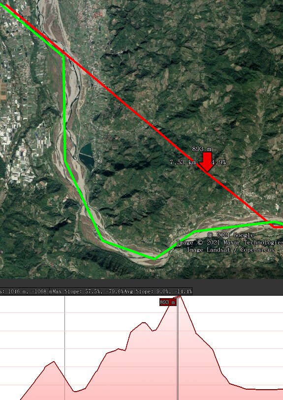
(圖 Image: 由新社飛往和平剖析圖 Xinshe to Heping elevation profile (Google Earth.))
99% 的直昇機沿著大甲溪標準路線(綠)。 但萬一因某原因切捷徑(紅), 很可能穿越我旁邊的埡口。 而其整個飛行之高度, 取決於本埡口之高度 (略高於其高壓鐵塔。)
99% of the helicopters here stick to the standard Dajia River route (green). But if for whatever reason a pilot decides to take a shortcut (red,) it will likely be right through the nearby mountain gap -- which determines the altitude needed for the entire flight (a little higher than the power tower there.)
睡午覺驚醒, 打開眼鏡, 直昇機那麼大…
Awakened from siesta, opening one's eyes, "Wow, what a big helicopter..."
Last modified: 2021-03-12 16:30:39 +0800