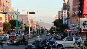
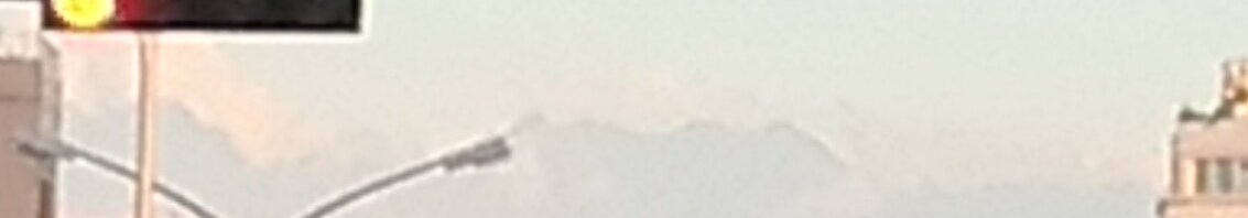
沿著直直的路, 最後是什麼山? What mountains are at the end of this long straight road?
那麼, 採此圖很容易判定: Well, we can find out with this handy map:
曼哈頓懸日現象台中版是每年某幾天, 傍晚沿著某幾大馬路, 往西邊看夕陽。 今天我們來利用同樣都市峽谷概念。 只要是晴天, 換頭往東, 看山。 或晚上從山上看哪路燈串直直指我們。
The Manhattanhenge phenomena Taichung version is when looking west along certain roads at sunset on certain groups of days of the year. Today, using the same urban canyon concept, let's look east, on any clear day, toward the the mountains. Or, at night, from the mountains, looking back at what string of street lights points directly at us.
當然異路能指同山:
Of course different roads can point to the same mountain:
鳶嘴山 - 東勢區第一橫街
Yuanzui Shan - Dongshi District Diyiheng St.
鳶嘴山 - 建成路
Yuanzui Shan - Jiancheng Rd.
甚至一兩公里內幾乎所有平行的路也能,
Even all approximately parallel roads within a couple kilometers can too,
八仙山 - 進化北路
Baxian Shan - Jinhua N. Rd.
八仙山 - 英才路
Baxian Shan - Yingcai Rd.
鳶嘴山 - 建成路
Yuanzui Shan - Jiancheng Rd.
鳶嘴山 - 復興路
Yuanzui Shan - Fuxing Rd.
自其各台中路路口均 30 公里。
以上講的是嚴格見分隔島指哪山。 其實如站在該進化北崇德路口西南角往東看 (上圖), 再仔細來比對, 總共能看到:
So far we have been talking about what mountain looking strictly down the median divider of a road points to. Actually, e.g., standing on the southwest corner of Jinhua N. Chongde Rds. intersection looking east (image above), then carefully comparing, we discover we can actually see all of:
白姑大山西南峰 Baigu Dashan Xinanfeng
基隆山 Jilong Shan
九仙山 Jiuxian Shan
東八仙山 Dongbaxian Shan
八仙山 Baxian Shan
而且, 譬如一座長數公里平頂的山, 若不勉強要求任意定其某點為「山頂」, 那麼可見數條路會同指它。 又沿狹窄著都市峽谷, 反正也看不到哪裡是它的「中央」。
Furthermore, imagine a flat topped mountain many kilometers wide. Well, if we don't insist on defining an exact peak for it, then many streets will point to it. Also down a narrow urban canyon one couldn't see where the "center" of the mountain was anyway.
本文僅舉本地幾條線為例, 拋磚引玉。
The lines in this article are just a few of the many possible ones for this area.
可以說, 一個完整版應該列:
逐條路指哪些山, 以及
逐座山有哪些路指它們。
One could say a complete version would list:
For each road, all the mountains it points to, and,
for each mountain, all the roads that point to it.
其實鄉下的路, 若直直的, 也能鑑別山:
One notes rural roads too, as long as they are straight, can point out mountains:
地方政府道路命名, 以所指之山, 予路名。
The local government could name roads pointing to mountains with the mountains' names.
但又可能同山有多條路指它(異路同名)。 又可能有另一條真的到那座山(頂)。 單向路可以, 但逆行萬一指另座山? (選較大的吧
(Note there might be more than one such road however (so two roads with same name!) And it also it might not actually be the same road that actually goes to the mountain (peak.) Also it would be great on one way roads, but what if traveling the opposite direction pointed to a different mountain? (Choose the bigger mountain I suppose.)
Peakview, Peakvisor etc. apps; HeyWhatsThat, Google Earth Viewshed...
是的, 還有這些, 但今講的低科技肉眼法, 免裝置。 可跟阿公講甲路指乙山, 「電池也沒, 仍能用!」
Indeed, there are also these. However our low-tech method of simply telling Grandpa road A points to mountain B, "even works without batteries!"
待畫 To be mapped later:
東勢區: 第二橫街、 第三橫街 (豐勢路以東)、 忠孝街 (三民街以東) → 小雪山 ; 東關路七段 (果菜市場以南) → 大平龍 (1179m); 豐勢路 (本街(南)路口以南) → 大茅埔山 (937m) ; 豐勢路 (東勢大橋至東蘭路口) → 九仙山。
Last modified: 2025-04-06 04:02:41 UTC